Home Up Site Map
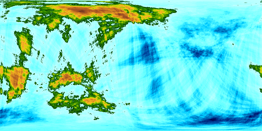
The map below is a contour map, with colours representing heights and depths; it is not intended to be a representation of what Gu-Pu-Kra looks like from space.
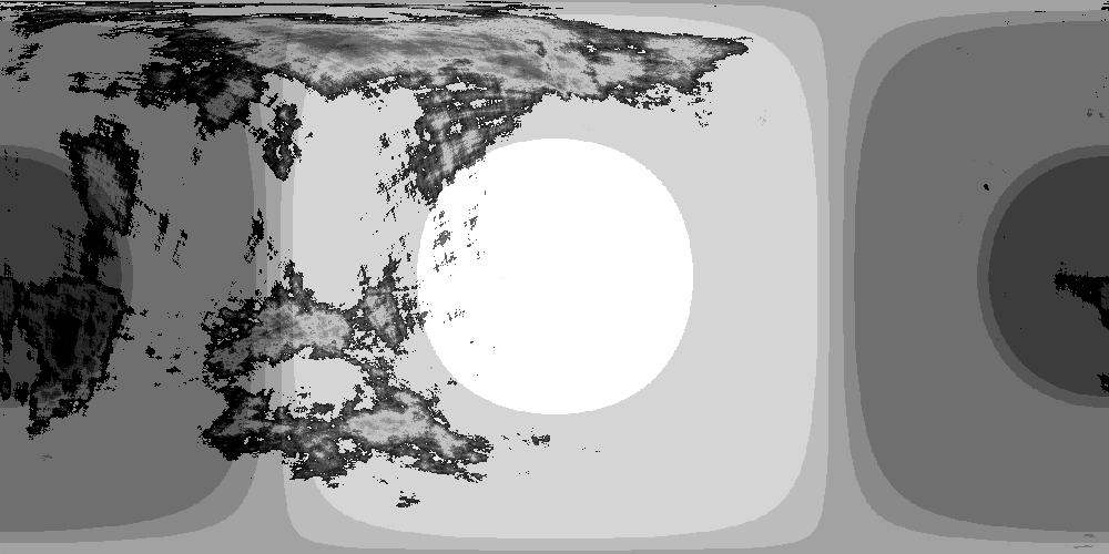
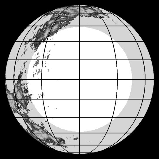
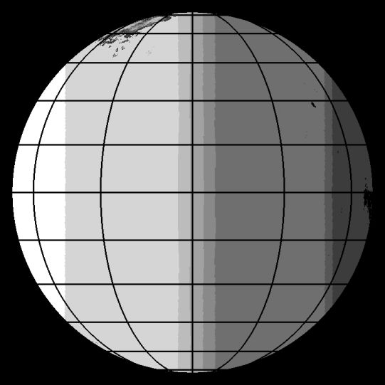
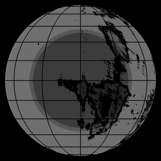
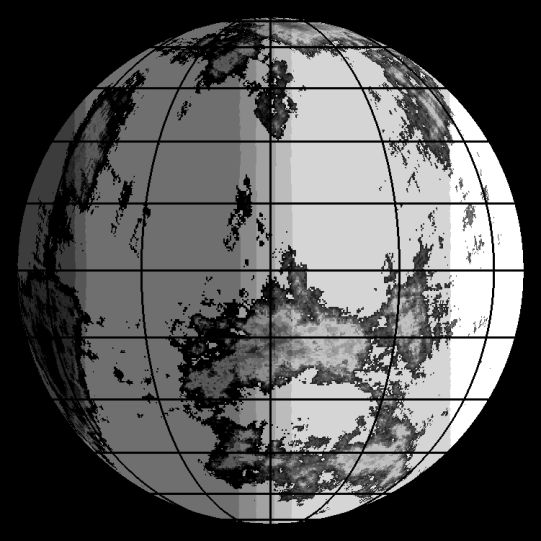
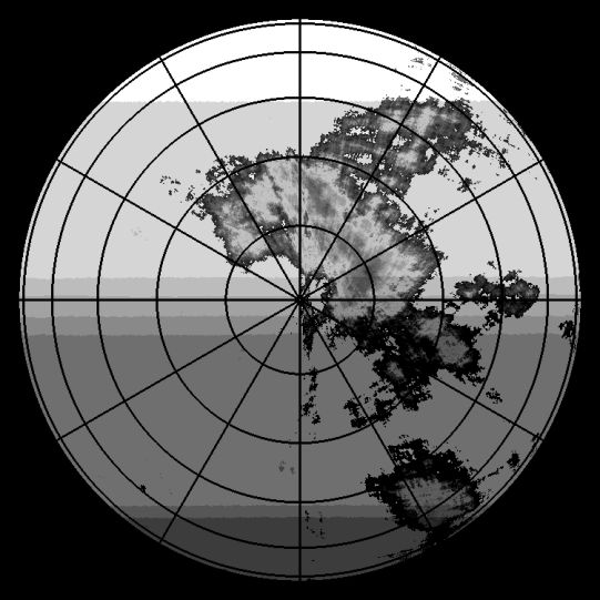
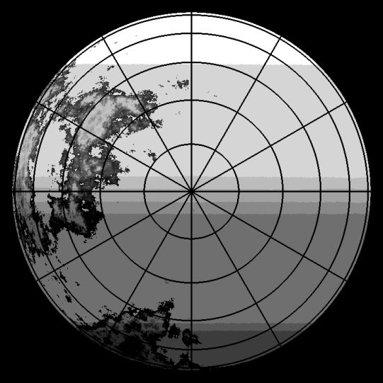
In the images below, the regions coloured in different greys are as follows:
- The white region represents Du-Bepdh. The core of the world-hurricane.
- The adjacent grey region represents Duo-Uap, the periphery of the world-hurricane, and Upgbpr-Wtdu, the hospitable lit regions sunwards of the terminator.
- The three next darker regions represent Ueb-Bgt, the terminator, that is, those regions where Rp'Gu sits roughly on or is partly hidden by the horizon, and where there is a day-night cycle. The three bands represent the inner, outer and average positions of this due to the extent of Rp'Gu in the sky and position shifts due to libration in the orbit of Gu-Pu-Kra; the lightest is the region where Rp'Gu is always visible but parts of it go below the horizon at times; the middle is the region where some of Rp'Gu is always hidden, and the last is the region where Rp'Gu is mostly below the horizon, but parts of it are sometimes visible.
- The next darker region represents Ugodugg, the twilight zone, those regions of Gu-Pu-Kra where Rp'Gu itself is never visible, but which are illuminated to differing degrees by the scattering of its light from the atmosphere of the planet.
- The darkest grey regions represent O-Ugrpdwt, the dark zone, that is, those parts of Gu-Pu-Kra that never see daylight. The lighter grey region around is shows the variation in the border of O-Ugrpdwt caused by libration in the orbit of Gu-Pu-Kra.
When projected onto a flat map of Gu-Pu-Kra the zones of Gu-Pu-Kra appear as shown on the following map:
This is perhaps not as clear as it could be...
When projected onto the globe of Gu-Pu-Kra the different zones of Gu-Pu-Kra appear as shown below.